Parcel Data is commonly used by:
Engineers • Surveyors • Utility Engineering • Oil/Gas/Pipeline Companies
Land Developers • Telecommunications • Forestry Consultants • Conservation
eBook Pro
|
The eBook Pro is a dynamic digital version of our traditional plat book. These are great for personal and business use and are commonly used by: Realtors, Bankers, Insurance Agents, Construction Contractors, Farmers, Engineers and Land Surveyors. Best part of all, the eBook Pro can be easily accessed from any of your devices since it is in a native PDF format. Desktop, Laptop, Smartphone or Tablet for use at the office or on the go. View sample video below, describing the features.
|
SmartMaps
|
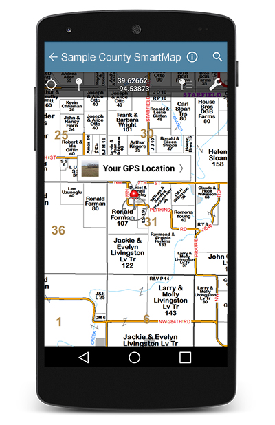
With the advancement of technology, our plat maps can easily be viewed interactively on your Android or iOS compatible Smart Phone or Tablet. The SmartMap is an electronic version of our maps that have been optimized for viewing on your mobile device. These files are provided in GeoTiff format, which can be viewed as a regular image file on your desktop or the recommended Avenza Maps on your mobile device. This app is available free for personal use on the Google Play or Apple App store. Commercial versions also available.
|

