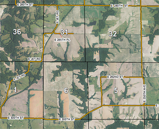
Martin-Daviess Counties Indiana 2019 Aerial Map
- Availability:
- Ships within 24hrs.
What is an Aerial Map?
Our Martin-Daviess Counties Indiana Aerial Maps show roads along with an aerial image providing an entire view of the county. These make really nice maps to hang on the wall to show all the topography of Martin-Daviess Counties! The scale varies by the land area size but typically measures 1 inch = .85 miles.
Overall printed map size is 42 x 48 inches.
Standard Martin-Daviess Counties Indiana Aerial Maps are printed in color on 32 lb High Resolution Coated Bond paper for durability and appearance.
Premium Martin-Daviess Counties Indiana Aerial Maps is the same image as our Standard Aerial Map, except it is printed on 90 lb Premium Photo Matte paper. This low-glare, high grade paper provides a beautiful, long lasting image for your Aerial Map. To order, check the premium paper upgrade box.
Both paper options are printed in full color. See sample image below.
Enlarged View of Map

Need more information or help finding the right product? Give us a call 816.903.3500 and we will be glad to assist you.


