What is in a GIS Parcel File?
GIS parcel files are files derived from our plat book building process that can be re-purposed for professional applications. These files are most commonly used by professionals such as: Engineers, Surveyors, Utility Engineering, Oil/Gas/Pipeline companies, Land Developers, Telecom, Forestry Consultants and Conservation Agencies.
Why use a GIS Parcel File?
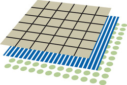
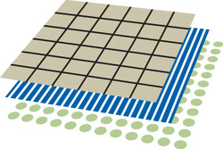
Parcel polygon data is all contained on one layer for easy editing and analysis. No clean up, data is ready to go.
Parcels can be incorporated with your existing map data layers and aerial photos. This will make one seamless map with all the information you need.
Additional layers can be added or you may draw on top of our layers. Example: Boundary lines, Oil/Gas Lines, Oil Wells, Water Lines, or any other information you may have that is needed on the map.
Additional layers can be added or you may draw on top of our layers. Example: Boundary lines, Oil/Gas Lines, Oil Wells, Water Lines, or any other information you may have that is needed on the map.
These files were built using ESRI ArcGIS software, but we can customize a solution for you specific application and specifications.
All data files are put together into one full county view and are created inside of a single Geodatabase for ease of use and organization.
Parcels are enclosed polygons which have the following attributes associated with them. (PIN Number, Owner Name, Acres, Township, Range, Section and more depending on the county)
The following separate layers can be included if needed: (County Roads and Highways, Rivers, Creeks, Lakes, Railroads, Section polygons and numbers, City Limits, Churches and Cemeteries & Subdivisions)
Map Layers are Geo-Referenced in coordinate system, State Plane NAD 83 (Feet).
File size ranges from 25-100mb.
Not all counties are available, please call for individual county availability.
If you are not sure if this is the right solution for you, give us a call and we will be glad to help customize a solution that meets your needs. 816.903.3500


